FROM BLISS PORTAGE TO WEDNESDAY LAKE.
Traditionally, most hikers camp somewhere along the trail from Sarah Point the first day and then high-tail it to Manzanita Hut from that camping spot. Now, with the NEW Bliss Portage Hut, the typical first day hike will probably stop here. Some of "tougher-than-me" types will dig down deep and go from Sarah Point to Manzanita in one jump; I call that missing the entire point of getting away from the rat race. On the other hand: you will have dependable cell service from Manzanita, so you will be able to check your corporate e-mail or important political Tweets.
This section will break with the logical protocol and cover just the stretch from Bliss Portage to Wednesday Lake. Wednesday Lake is one of the most pleasant little lakes along the entire SCT and has SO many access and egress points that it is appealing to the laziest day hiker anywhere (don't tell her I called her that). I'll tack a few pictures of the easy-in trails just for the day hiker.
I did this section as a "two car" hike. I parked one car at the southern access to Manzanita and then had my wife , driving my 4x4, drop me at Bliss Portage. I was a little out of shape for long hikes, so I felt exhausted and very relieved when I finally exited from Manzanita to find my little Smart Car waiting. I'm sure younger and fitter people will laugh at my discomfort.
Just wait: age gets us all.
Two car hikes will let you cover most of the SCT as a day hike. The alternative is really, really long walks. My father's day hike each year is Walt Hill by Branch 21. My feet ache just thinking about it.
 |
| From Bliss Portage the trail winds South through a wet lowland covered in a thick canopy of mixed deciduous and evergreen, the ground thick with ferns and mosses. |
 |
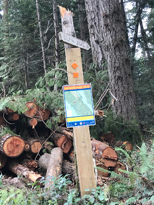
| Back at Bliss Portage. The visible bridge crosses the only water source for the hut and the trail winds up a small hill and around a gentle bend to open into the small clearing that shelters the Hut. If you choose to stay north of the creek and follow the Bliss Portage road down the hill going East, you will eventually find the ocean. If you keep going you would be swimming. Turn back. |
 |
If there is any doubt in the construction quality of the new hut, check out the picnic table at the site. At least we know the guys had their priorities straight: food before shelter.
|
 |
Back at the Bliss Portage Beach. Not prime swimming since the beach is rocky. The water is the same chilly ocean water though. No sharks, just a few billion barnacles.
|
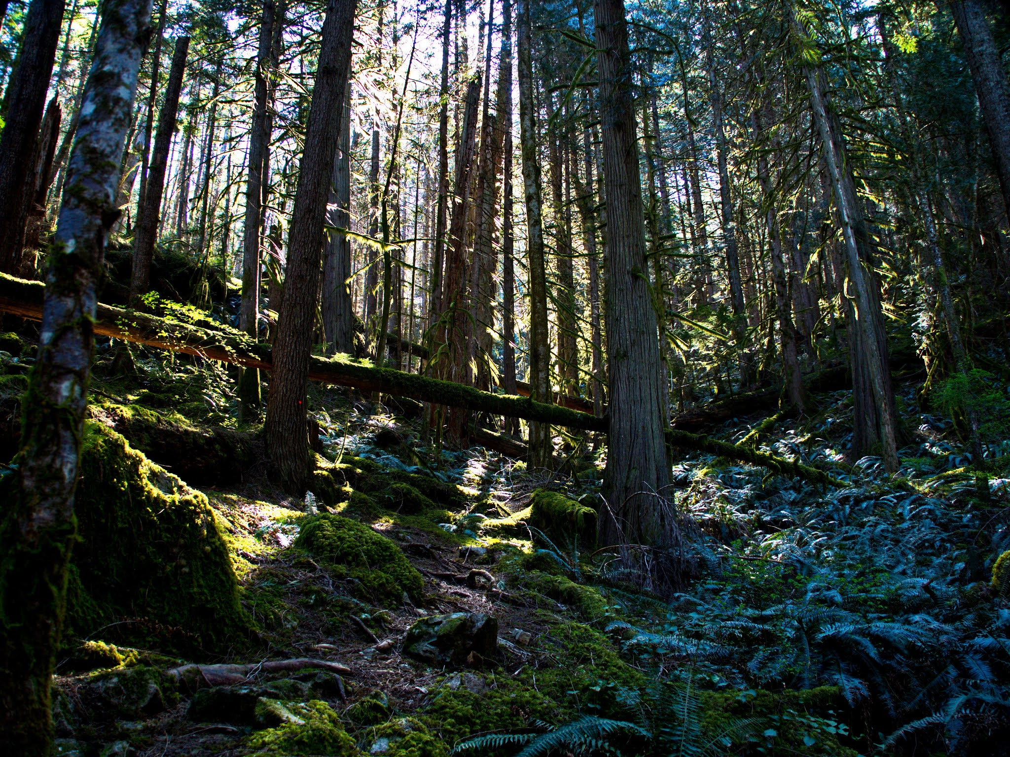
Along the trail from the Portage to Wednesday Lake. The foliage is thick and everything has a feel of ancient life, death and decay. Trees are thick with moss and winding vine, the ferns choking every inch of bare ground around. The SCT, as always, winds the hiker through all of this with a clear, well marked path ahead. Breath deeply and enjoy the rich, earthy miasma that fills the air: this is just a shadow of what was once here.
 |
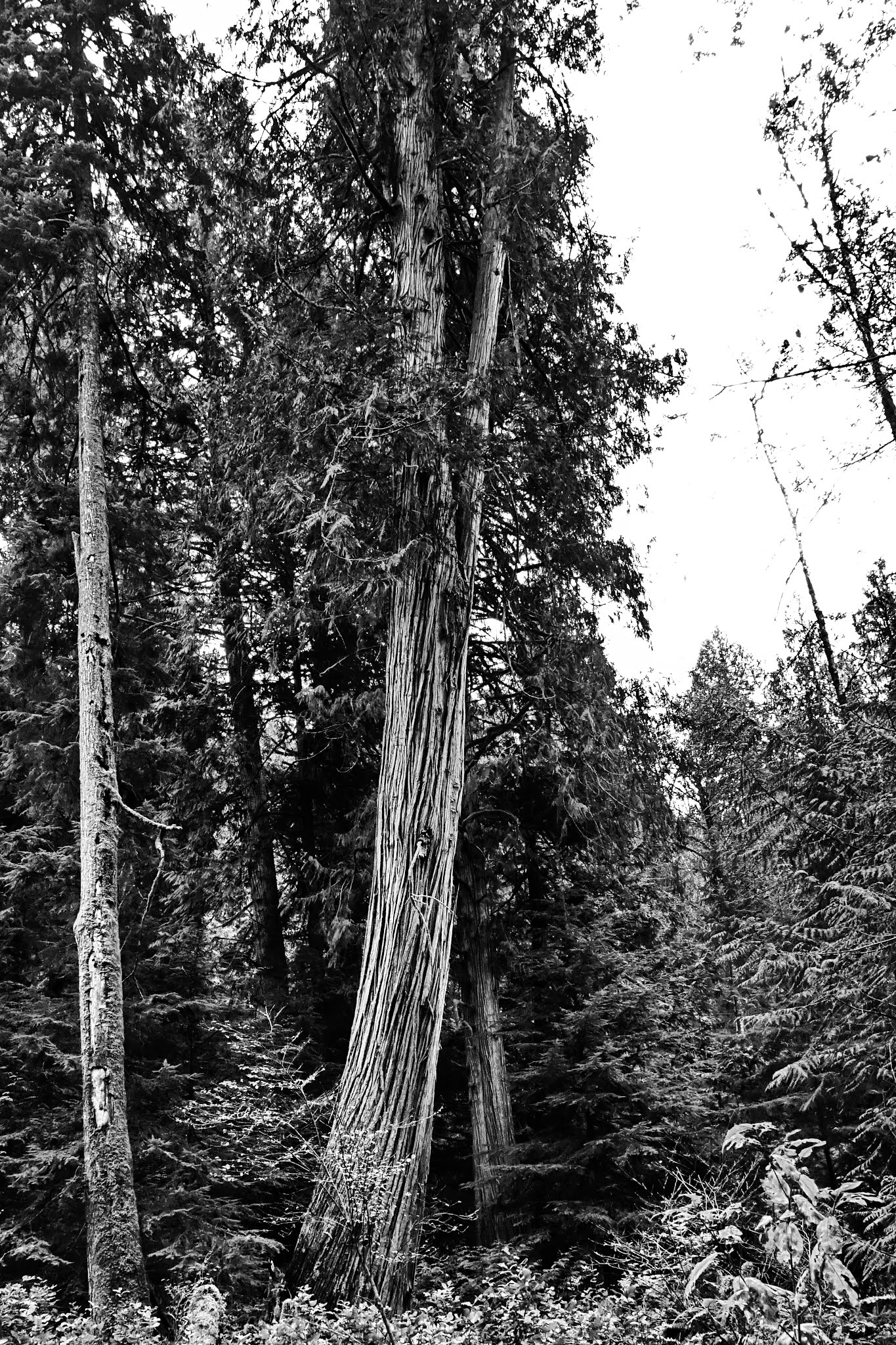
A forest giant keeps sentry just north of Wednesday Lake. There is just no way to give anyone an idea of how big these Grandfather trees really are.
|
Wednesday Lake: the bench there sits upon a rock bluff that drops in steps down to the quiet lake. If you watch the waters below you will see the odd fish....or tadpole (those tadpoles are huge out here on the coast) The camping area is pretty wide here, appropriate for biosecurity in the age of the zombie apocalypse. If you follow a short trail heading east found just behind the "bench area" you will stumble upon a more secluded and flat area appropriate for a tent.
Anywhere along the SCT the hiker really needs to pay attention to fire regulations. During the dry months of July and August the woods will explode if a wildfire gets going and you won't be able to outrun that flame. I'm not sure open fires are permitted at Wednesday Lake.
BTW: the only outhouse here is an incredibly rustic wooden structure somewhat north of Wednesday Lake along the SCT. Not terribly handy for campers, but far enough away from the water to be safe.
I really like Wednesday Lake. It kind of reminds my of the teen-age hang-outs of my youth where we would camp out on the closest exposed bluff, bake our bodies to a golden brown, ignoring the warnings of too much sun, and then jump off the closest bluff into an ice cold lake below. Sun tan, rinse repeat....
I will touch base on the other accesses to this spot from here.
 |
Gilpin Road Access.
|
Gilpin Road access is probably the easiest approach to Wednesday Lake for "day hikes". I strongly recommend this hike: it's a gentle stroll down a rarely and barely used access road that angles NE from it's entrance off of Sarah Point Road, about 1 to 1.5 km from the last lonely house right on Sarah Point Road. It has a pretty nice parking area now; two or three vehicles space, well off the road.
Gilpin Road itself is very easy walking with just a few gentle hills along the way. There is one detour along the road where the original road passes through the middle of a shallow lake; that trail is just a short stroll that skirts a small duck pond and crosses the creek that drains the lake. The total walk is about 4 km if you stay on the main trail and will put you at the south side of Wednesday Lake, feeding into the SCT on a well marked branch. |
| There must have been some effort at civilizing this area at one time: I don't think these giant laurel trees are native to this area. The road you can see pretty much typifies the trail. |
 |
That yellow-green area on the far side of the pond is where the road passes. This is taken from the bridge crossing the outflow, complete with a beaver dam. HOOVER DAM ! I never get to see the darn beaver. A few ducks but no beaver.
|
 |
The little duck lake that the bypass trail skirts: I was actually tempted to walk out along that log to get a unique picture. Then I remembered that I'm no gymnast and my cameras are not waterproof
|
 |
the first glimpse of Wednesday Lake along the south shore.
|
The Gilpin Road Trail ends at a junction with the SCT just at the southeast corner of the lake. The SCT drops off the granite table where the camping area is and onto a bridge crossing the creek that flows east to Okeover. This is an important point that the through-hiker needs to heed. More on that later.
The Gilpin Access has one side branch, Ann Gustafson Way that skirts the north edge of the lake to meet the SCT. I followed that trail last July and I can see it is "the road less travelled", but like the eponymous Frost road, it still ends up at the same place.
 |
| You have to look for the sign. It's a bit mossy and well worn these days |
 |
There is a swampy sibling to Wednesday Lake just slightly north and west: we can call it Thursday Morning Hang-over.
|
 |
the odd bit of flotsam and jetsam left over from the logging days
|
 |
| And here we are, at the Northeast corner of Wednesday Lake, just short of the junction with the SCT. |
 |
| The eastern terminus of the Gilpin Access. This photo was taken from the bridge crossing the creek that drains to the sea. |
I'm not sure why I don't have a picture of the big sign that adorns a tree on the SCT just as you cross the bridge and leave the idyllic Wednesday Lake, but the sign says two things: this way to Manzanita and NEXT WATER 7 Km. This is an important point: you are literally standing on a bridge over the last potable water until you reach the far side of Manzanita AND that water source, down in the valley as you depart Manzanita, is not very appealing or dependable. I'm pretty sure the average dog would look for a better puddle. Fill up your water jugs here or no soup for you when you get to Manzanita.
There is one more access point that the day hiker wants to know about: the Doctors Chute. It's a well marked branch trail a couple of kilometers up the SCT from Wednesday Lake. The Chute drops sharply off the ridge as the SCT traverses the Gwendoline Hills heading south. The SCT along this path is an easy stroll along an old logging cut, but it's a bit frustrating since the hiker will get just glimpses of Okeover Arm to the east, but no real views. The Doctor's Chute is a steep little trail dropping down to meet Gilpin Road; it's worthwhile to keep in mind because it also provides another handy access to Manzanita Bluffs.
 |
| There are a few steeper spots right immediately south of Wednesday Lake, but the trail quickly feeds into some very tame and wide old logging cuts with very gentle grades. |
 |
This is a good place to point out that not all the signs along the SCT are of the "large and official" type. Some are more improvised
|
 |
Most of this trail is pretty tame.
|
The majority of the SCT through the southern end of Malaspina Park follows the old logging trails through the Gwendoline Hills. A view of Okeover and the distant Munster Range is right there if you could just find one break in the trees. Now, I've not yet gone bushwacking to find that view, but I know I would get lost trying.
 |
| and down the Doctor's Chute we go. It is a good, solid trail, but it is substantially steeper than most of the rest of this section of the SCT. |
 |
The exit of the Doctor's Chute at Gilpin Road. I honestly have no idea how I missed seeing it on my way out to Wednesday Lake, but it was a revelation when we burped out back where we started. I pretended to know where I was at all times: the key to being lost without anyone else knowing.
|
I'm not sure the Doctor's Chute is one iota shorter access to Manzanita as compared to the much more commonly used south access found about 1 km short of Gilpin Road, not too far from the last lonely house on Sarah Point Road. For the hiker dedicated to doing loops rather than "out and backs", one could enter at Gilpin Road, hike up the Doctor's Chute, visit Manzanita and enjoy the view, then continue south along the SCT and then exit by the southern access to return to Sarah Point Road, using the road to meander back to your vehicle parked at Gilpin Road.
 |
| Nothing to do with the SCT: I just had to add a little color at the end. |
Dyfal donc a dyr y garreg: Persistent tapping breaks the stone.


Comments
Post a Comment