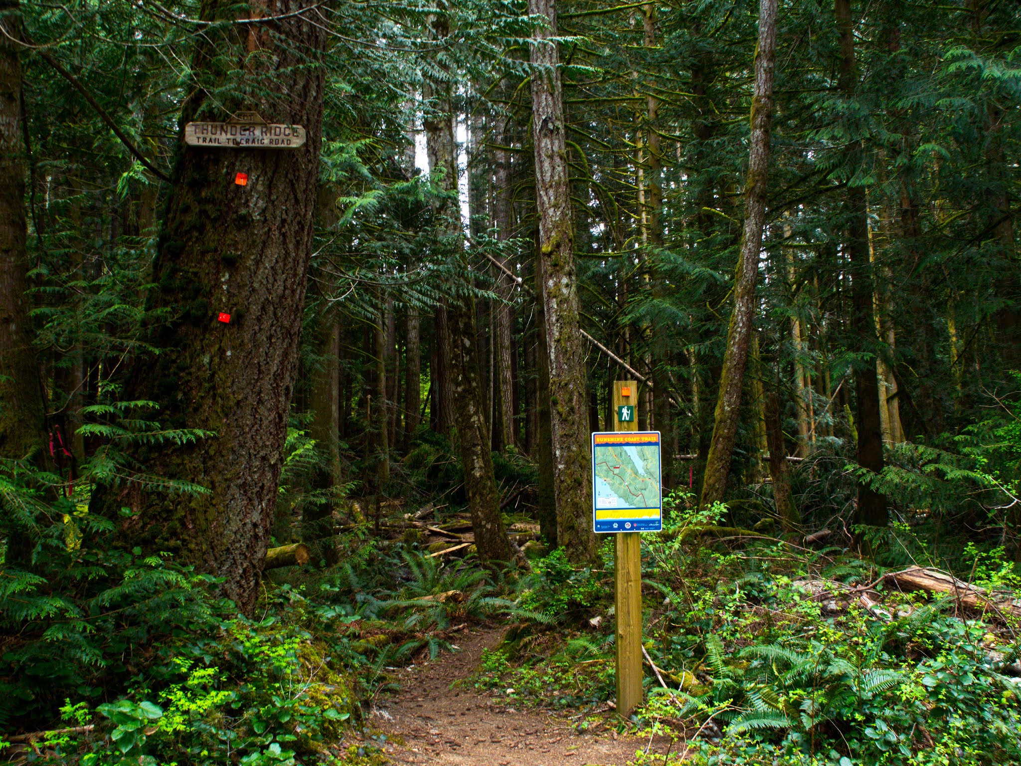
THUNDER RIDGE:
Malaspina Road to Plummer Creek Road
This is a fairly short and relatively easy part of the trail. The southern section dropping off the summit of the ridge descends quickly, but there is really no exposure here unless the trail is wet and a bit slippery.
The Malaspina Road trail head is of interest for runners: it's the traditional start point for the "Marathon Shuffle", a springtime ritual for crazies that like to risk life and limb by running on trails made for hiking. Not my thing, but then I would debate running from a bear because it would mean actually running, a life threatening and futile activity regardless of what's chasing me.
The first water source along this trail would be Fern Gully, but the last time I walked by that creek it was dry as a bone, so I would never count on water there. The only truly dependable source of water is on the other side of the ridge at Plummer Creek. That's about 4 km away from Malaspina, but it will be shady most of the way. There is a nice campground at Plummer Creek.
 |
There is good and plentiful parking on Malaspina Road and Plummer Creek Road is a dependably good dirt road: narrow and bumpy but not necessarily 4x4 dependent.
|
"
On the first part of the journey I was looking at all the life
There were plants and birds and rocks and things...."
No horse though, even one with a name.
The trail winds gently beside Malaspina Road, popping out of the forest at one point on a cut-bank above the road, and then plunging back into the maturing forest before bending south toward Fern Gully and Thunder Ridge.
 |
| Fern Crossing. It's a little idyllic, like something you would expect in an elven woodland kingdom. |
The trail is very clear, soft and flat. It bends southward and, once you pass the huge iron wheel it will start to climb up to the ridgeline on an old logging road. It's a bit huff and puff, but nothing too challenging...even to old farts like me.
 |
| The big wheel. |
A few yards after the big wheel, the trail starts to climb up the vestiges of the old logging road. It's not terribly steep or long, just enough to give you a good work-out in preparation for the later, more challenging parts of the trail.
 |
| Across the ridgeline, the trail is perfectly straight and impossible to get lost on. |
 |
| This is a picture for directions: do not go right, stay left. Judging from the multiple signs and numerous arrows in bright orange, I think a couple of hikers have ended up wondering what happened when they emerged back on the 101, kilometers off course. |
After the well marked fork in the trail, the path descends down the southeast flank of the ridge, first following a logging track, wide and gentle, and then funneling into a narrow, rocky and a little steep trail. Nothing too challenging, just more hiking than walking now. Eventually the trail flattens out a bit and you will see the twin sentinels, last giants of the old forest. The trail drops down from there, heading towards where Old Gnarly used to hold court.
 |
| The remains of Old Gnarly |
There is a learning moment here: Old Gnarly, a giant of legendary proportions, was left as a solitary tree surrounded by a barren clear-cut. Standing by itself, exposed to the winter winds, it eventually fell. A giant is only as strong as the forest around it to resist the elements as a community, bending together and supporting each other. Perhaps we should all consider that truth in these days of prideful "rugged individualism". The lone wolf starves, the single tree falls, the bull buffalo without a herd is just food for the pack. |
The moldering corpse of Old Gnarly.
|
South of Old Gnarly, the trail snakes through a young forest of deciduous scrub. It's quite pretty in the spring and summer with it's brilliant green foliage. In the fall the trail will be slick with fallen leaves and the trees will be coldly barren.Below your feet, watch for the beauty of spring; tiny flowers of bright blue and deep magenta. Certainly there is beauty up in the mountains and out upon the sea, but sometimes the little details at our feet need to be appreciated too.
 |
At Plummer Creek Road, the trail head for the Toquenatch Trail immediately across the road. The Plummer Creek camping area is down the Toquenatch Trail; take a hard left at the out-house and go a few hundred yards south to the tables.
|
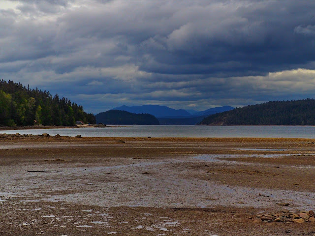 |
For the few curious souls that just have to see what is "at the end of the road", the Plummer Creek Road bottoms out at about sea level: a little bit of a walk down and then north aways will put you at the head of Okeover Arm.
|
 |
| Oooh: wildlife. The wild and crazy slug, a snail without a shell. Escargot anyone? |
Mwyaf y brys, mwyaf y rhwstr: The greater the hurry, the more obstacles there are.


Comments
Post a Comment