THE SLIAMMON LAKES
The hiker will exit the Appleton Creek trail into a small parking area and hang a left, heading out the short driveway coming off of Tomkinson Road. Track across the road and look south. It's hard to miss the trail head. You can try, but really: getting lost here does not bode well for the rest of the trail.
 |
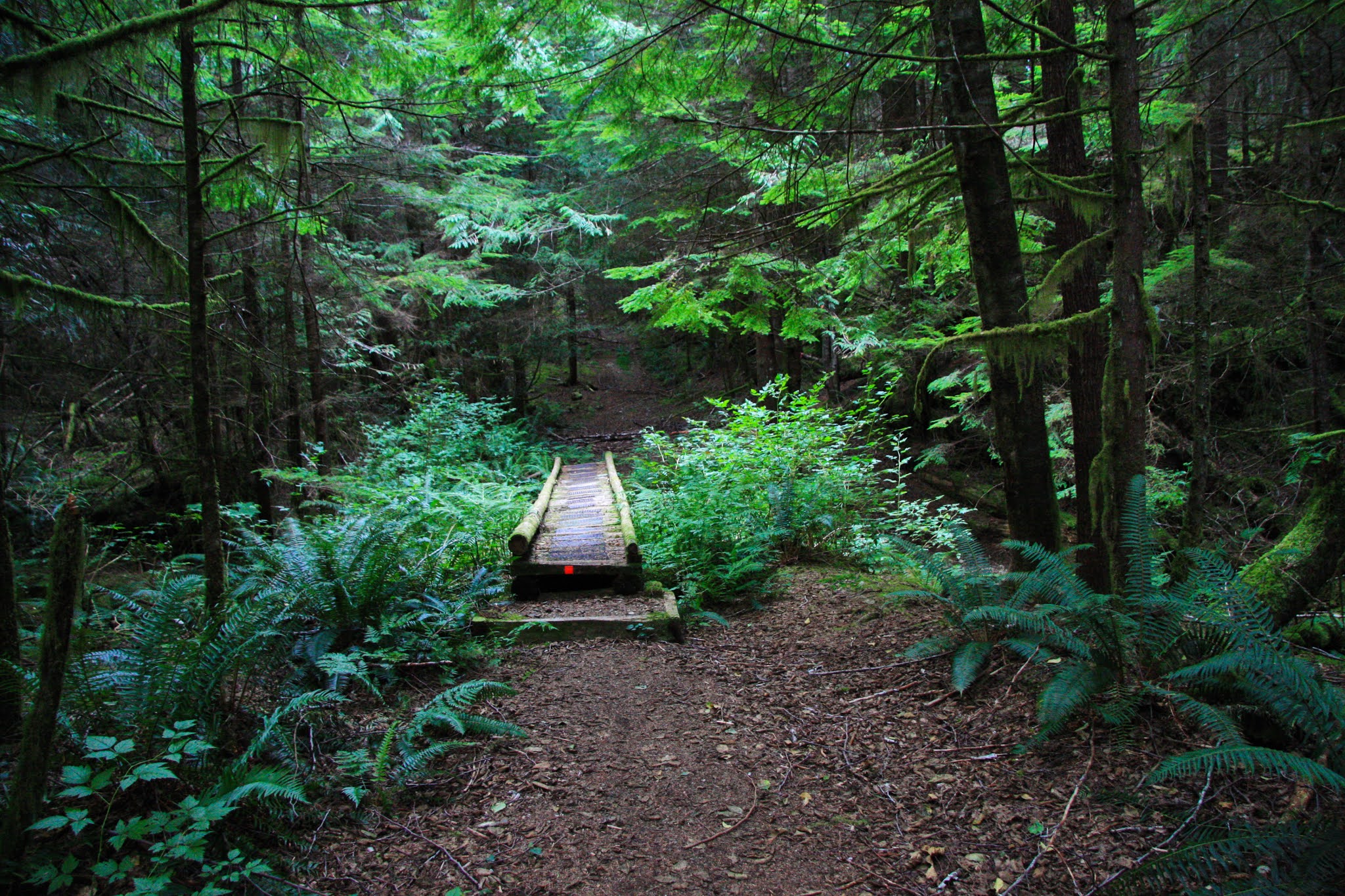
| Sliammon Lakes is all trail: not old logging roads, no logging rail grades with their gentle grades: just a wonderful winding trail through rolling hills and bordering four lakes, each with their own character. While it's important to respect the land everywhere, this section cuts through the heart of the Sliammon Tribal Lands. The hiker is a guest on First Nations homelands here: be a gracious visitor. |
From the first step, the Sliammon Lakes Trail is appealing: it arcs down into a shallow draw, crosses a bridge over a seasonal creek and then cuts westward across the opposite hillside, eventually curling over the crest and wandering southward. On the far side of the crest the first of many idyllic retreats is found: Faerie Falls
 |
| Through the glen |
 |
| and across the hillside |
 |
| Over the crest and down into the Faerie Hollow with Faerie Falls. Moss hangs from branches and the peaceful but undependable creek trickles down a black rock face. |
Follow the trail and it will wind through the forest, rising up onto a plateau at the foundation of the west face of Bunster Range that overhangs the Southwestern edge of Powell Lake. In just a few minutes the hiker will reach first of the Sliammon Lakes: Theyeth. I find Theyeth remarkably pretty and, seasonally, it is a chance to play with your color photography.
 |
| Theyeth at mid summer. |
 |
| From the north end of Theyeth |
 |
| A duck patrols his realm on Theyeth. It almost has a Monet Lily Pond feel to it. |
 |
| from the south end of the lake |
 |
| I have no idea what the leaves are from, but it's colorful anyway. |
Beyond Theyeth Lake, the trail slowly climbs onto a bare stone bluff, Kayach (being spelling impaired I had to check that name no less than three times) and you will catch your first view of Big Sliammon Lake. The bluff is a window on the west and, early in the morning of a clear day, before the inevitable haze rises off the Straits, a person can see across the forested Harwood Island to the alps of Vancouver Island, cloaked in snow most of the year. Take a couple of moments to relax on the bench there before descending to the campsite at the shores of Big Sliammon.
The Day hiker will have already seen Big Sliammon Lake while driving in along Tompkinson Road, visible to the south for a good proportion of the trip. There is a small camping area at the far west end of Big Sliammon, found down a unassuming side road.
The campground at Big Sliammon is large, shady and quite civilized. There is excellent access to the lake for bathing and a rustic outhouse not too far uphill. A creek at the south side of the camping area has clean water. Photographers take note: there are many great places to photograph this lake along the coming trail, so don't despair at the heavy brush cover right here at the campsite. You just need to get up early enough to catch the Golden Hour.
 |
| From the bench at Kayach Bluffs on a hazy, slightly overcast day. I had been lazy that day and did not get hiking until any decent light was long gone. The nature of landscape photography is early morning and late evening with a power nap in between. |
 |
| Big Sliammon at mid-day in mid-Summer. Great for swimming, not so much for photography. |
 |
| Glass smooth Big Sliammon at about 7:30 am. Here the photographer opens up the f-stop to 4.0 or less if you can and perhaps set your exposure compensation to minus 1 to give the blue full saturation. I usually shoot at ISO 200 or so, but here I might go quite high to really catch that mirror calm. |
 |
| I think the darn ducks gave the water a bit of a ripple. I had a word with them about the photogenic value of glassy water and they told me they didn't give a duck about my issues. |
 |
| Still not perfect, but the colors are really nice. Note how the dead trees almost disappear in the green jumble of the reflection. |
 |
| There it is: almost perfect mirror. I could flip this photo end for end and most viewers would miss the trick. |
The SCT shadows the lake shore for quite a distance then makes a hard turn south into the shallow valley created by Dogleg creek. The creek itself is just a quiet little brook that descends in a series of short tumbles. The feeling is of a formal "nature" garden rather than real nature. About half-way up the draw, the hiker will find the Last Lonely Outhouse. What possessed anyone to put an outhouse here is a bit of a mystery; I cannot believe that the pit is all that deep since the granite bedrock is barely buried under the forest litter. Either way, it's kind of like finding a functional payphone in the inner city: what the heck?
 |
| Dogleg Creek. |
If I was a duck, Dogleg Pond is where I would rest. It's sheltered, it's shallow and there are lots of nooks and crannies to hide in. As far as the dog's leg: Greyhound or maybe a Great Dane. Definitely not a Dachshund or a Basset. The long portion is mighty long and the top of the leg is a big round puddle with a marshy islet to nest on.
The SCT literally skirts the edge of the pond, flirting with dumping the hiker into the water at some spots.
As I skirted the pond last hike, I heard some loud singing coming from the trail ahead. A few moments later a young couple came into view. I did not have the heart to tell them they were both out of key. They explained their tone deaf "a cappella" as they passed: a young black bear was ghosting the trail a ways back and they were just playing it safe. Well, that's just waving a red flag in front of this old man: I went into stealth mode in hopes of finally getting my bear portrait. No such luck: who the heck needs bear spray when they have the perfect repellant hung on their neck: a camera. On the other hand, if I had been singing instead, the bear probably would have assumed I was a wounded and dying animal and emerged from the forest to put me out of my misery.
 |
| Dogleg Pond. And more of those colorful pond leaves. |
Once you walk off the foot of the dog's leg, it's not too much farther down the way that you approach Little Sliammon Lake. The trail enters a tight stony draw where the trail divides: continuing straight will take the hiker to a swimming hole while following the left (South) branch will take a person up a stony bluff and out onto a granite plateau overlooking Little Sliammon Lake.
The last time I hiked the Sliammon Lakes Trail, I walked from the South end, starting at 6 am, barely after sunrise. I managed to get to Little Sliammon a little before 7 am and the effect was magical. It was silent, the water glassy calm and a faint mist rose off the warm lake into the cool morning air. It was just me and the cryptic animals watching me from their roosts and dens. I could finally hear my own thoughts without the background noise of modern nattering and I was so glad I was there.
As I walked along the trail, heading North since I was going against the tide, I heard a loud crack from the trail behind me. I paused, assuming a deadfall had broken loose or perhaps I was not alone on the trail after all. Then I looked down and saw the first beaver I have seen since I left my old home in Saskatchewan. He had seen me pass and felt obliged to warn everyone that man was present. I could have stayed watching him all day, but he got shy and disappeared somewhere along the shore below me, probably crawling into a hidden den.
 |
| 7 am and the mist rose off the warm water into the cool morning air. |

 |
| This was taken in the fall of 2019. My wife and I were alone at the docks and there was a feeling of impending winter; peaceful, tranquil and everything settled for the season. |

 |
| The early morning calm, before the summer swimmers have arrived or the afternoon breeze has rippled the water. You can hear your own heart and it's calm and in rhythm for at least the moment. |
 |
| Trust me: it's a beaver and not a log. It was swimming and logs don't swim. |
At the south end of Little Sliammon, the combined efforts of the venerable BOMB squad (Bloody Old Men Brigade: self named), PRPAWS and Tla'Amin Wood Products created a nice shelter and a good swimming dock. The dock has a green canoe sitting at the very end of it (at least it has every time I have walked through); I'm not sure if the canoe floats, but it makes a great prop for a photograph.
Here is a nice "international" story about the shelter at Little Sliammon. A good friend of mine was sheltering there during a summer rain storm, cooking some wieners (also known as heartburn igniters for old men) and brewing up some hot tea. Out of the torrential downfall comes a foursome of Austrians, soaked to the skin and cold to the bone. My friend, a gregarious and generous soul, offers up some hot tea and a barbecued lunch. The Austrians gratefully accepted his offer and started telling him about their hike thus far.
It was becoming clear to them that the trail was going to break them before they finished the hike; they were not used to hiking with 60 pound packs and the father in the group was feeling the weight in his back. They asked if there was any "shortcuts" they could take that would let them see some of the highlights of the trail without having to call 911 for dear old dad (the guy was probably my age so....not quite dead yet).
My friend had some ideas and he left them his cell phone number to call if they needed any help. Knowing that I took a special interest in the trail, he called me and arranged for us all to meet at Julie's Airport Diner for an early breakfast the following day. I arrived with maps and The Guide Book in hand (I had a spare copy) and my friend offered to drive the entire crew to the top parking lot at Tin Hat. The plan was for the Austrian quartet to hike Tin Hat to Lois Lake Camp Ground, catching the beauty of the middle and most isolated part of the trail.
I'm not sure whether the Austrians really understood the depth of my friends generosity: the upper parking area at Tin Hat is not a short jaunt on a civilized road. The last few cross ditches can be a challenge if your clearance is poor.
The Austrians finished their hike well and thoroughly enjoyed their Canadian visit, fully appreciating my friend's gracious hosting. The rest of the story: my friend remains in close contact with the Austrian father to this day. When Ted travelled to Europe (before the Zombie Apocalypse) his friends drove two hours to spend a day with Ted and his wife.
Generosity and being a gracious host pays in ways that cannot be measured in coin alone.
Leaving Little Sliammon, the SCT circumscribes a relatively recent logging cut. The young growth, planted soon after the area was logged, is growing well and, within a very few years this area is going to be a beautiful green rainforest. There are still a few giant grandfather trees left in the clearing; standing alone it's hard to judge how big they really are. I always love seeing those towering lords of living history.
 |
| Still does not show how big this tree is: what I need is to convince my wife to get up and going at un-Godly hours so I have a reference subject.....Yeah, that's not going to happen. |
The SCT crosses the logging cut and climbs uphill, transitioning to a stone tabletop, covered in moss and lichen and ringed by a mixture of Arbutus trees and conifers. You may have noticed by now that Arbutus trees are the favorite dining room for Ixodes Pacifica, our local tick.
The tick population is a potential source of Lyme disease, but at last survey, the prevalence appears to be less than 1% of submitted ticks. To add to that, less than 10% of dogs will become symptomatic for Lyme disease if infected with the causative agent Borrelia, so don't panic if you find a tick on your dog. The ticks are just vampires. They don't burrow into the body or attack the brain. They are just blood suckers.
We tolerate the blood sucking politicians of the world; I think we can look the other way for a few ticks.


Dropping off the stone table, the SCT finally feeds out into a rabbit warren of old logging roads. One needs to keep an eye out for the ubiquitous orange trail markers; there are no shortage of branches off the main track. Like the proverbial Roman roads, all these trails eventually end up at the very end of Southerland Road in the Powell River suburb of Wildwood; it may just be a while before you find yourself again.
 |
| In the early morning hours, the sun peering in from the East. |
 |
| On an unsunny day in the early fall. |
Whenever one is in Wildwood, it really pays to keep a keen eye out for bears.
Do bears poop in the woods? Heck no: they don't even live in the woods. Bears live in Wildwood, savaging the local fruit trees and helping everyone dispose of their garbage here, there and everywhere.
As an added attraction, before attacking the last lonely hill, Scout Mountain, the hiker can take a side trip when they approach the end of the Sliammon Lakes Trail. At the base of Scout Mountain there is a well used track heading sharply down-hill towards 3-Mile Bay.
3-Mile Bay (it's three miles from somewhere, but nobody seems to know where) is a shallow, protected bay at the west end of Powell Lake. It is a good swimming hole for the weary hiker. I'm not sure it's private enough for skinny dipping, but I'm pretty sure nobody needs to see me naked, so it's not an issue for me.
 |
| 3-Mile Bay: I'm told it's shallow and relatively warm. To me that's kind of like saying my refrigerator is warmer than my freezer. Still makes bits and pieces shrink on contact. |
 |
| There were flocks of this tiny blue bird there the day I explored the Bay. Bug eaters. Flew like the burrowing cliff swallows I remember from my youth. |
 |
| A peculiar white fungus illuminated by a single beam of sunlight cutting through the high canopy |
 |
| After spending decades living in the city, I had forgotten the beauty as the sun fell into the west and the vast ceiling of stars appeared above. Eleven years now and I still stop in wonder at the night sky. One of those stars out there is named for my daughter. I probably could not find it with detailed instructions, but it's enough to know that it's always out there. |
Gorau prinder, prinder geirau: The best shortage is a shortage of words. Something I obviously have never learned.


Wow, such a great write up and awesome pictures of this section of the trail, I felt like I was there with you. It is definitely one of my favourite sections. My only objection is the connection between the arbutus trees and ticks. I grew up in arbutus country on Vancouver Island and never had a tick on me. Here I'm a tick magnet, but I've had my encounters with them in my own yard, sadly no arbutus in my yard and in a park with tall grass. I strongly feel the arbutus, tick connection is a Powell River old wives' tale.
ReplyDeleteRegardless, I so enjoy your writing! Thank you for sharing ��
I'm sure you are right...but a guy needs to have something to say. I have yet to get a tick on me, so I cannot say I know where to find them. Out in Saskatchewan you could count on getting a herd of them migrating up your legs if you walked pasture anywhere in the Qu'Appelle Valley: mostly clay based grassy woodlands. On the other hand if you were down the #33 into the sandy soils, the tick issue was a non-issue. Something about the soil types and relative moisture. Here we are dealing with a different tick type so I have yet to figure out where they like to hunt. I just find people are WAY too paranoid about ticks around here. They nearly panic about a tick feeding on Fido and then shrug when Fido brings Mr. Bear home to visit.
Delete