Inland Lake and up to Confederation Hut
 |
| This week: both the absolute easiest section of the trail paired with one of the major challenges. |
Inland Lake and the Confederation Hut trail introduced me to the Sunshine Coast Trail AND taught me true humility. They also taught me to look at a topographical map before I nonchalantly plan a day hike up a bloody mountain.
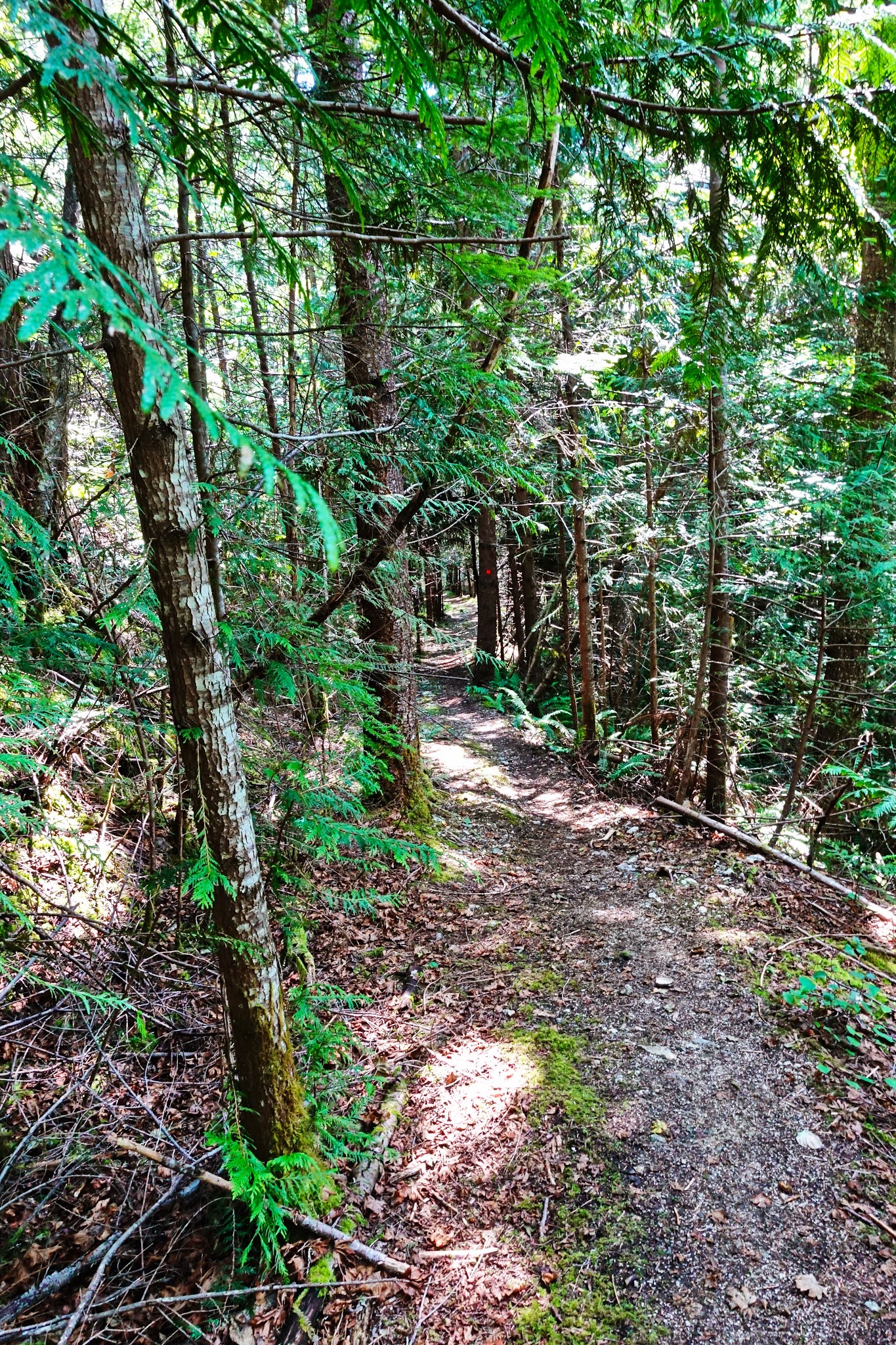
Astute observers will note that the Inland Lake Trail is essentially a 14 km loop around the shores of the lake. The trail is wide, smooth and flat. In fact, the trail could be considered wheel chair accessible if the person had a really skookum all terrain wheeler. I'm told they exist. The Haywire Bay-Lost Lake trail enters the loop at a point about equidistant from the Confederation Lake trail no matter which direction (clockwise or counterclockwise) the hiker chooses to go.
If you are using Inland Lake campground as a restocking point, then I suggest you go counter-clockwise toward the south end of the lake. That direction will take you through the busy campground. Beware: in the summer this is one busy little camping area and there will be lots of everyone and they will all likely be in a summer jovial mood. Quiet, introspective times are best left for the rest of the trail.
If you are NOT restocking at the campground, I would suggest you turn North and head clockwise around the lake. It maybe my own bias, but I prefer the North end of the lake.
 |
| Inland Lake in context: in a fold of the southeast shores of Powell Lake. |
 |
| Looking North from the Southwest corner of Inland Lake |
 |
| Looking North from the Southeast corner of Inland Lake: same lake two years apart. |
 |
| A mid-summer's view of the North end of Inland Lake. |
 |
| South from the North end of Inland |
 |
| Three Islands on a September day as summer waned. Kayakers could be heard having a picnic on the left island. They were debating the value of more sunscreen. |
 |
| A humdrum photo, but still important to the hiker: that notch you can see is the Pearson Pass which must be climbed over to reach Confederation Lake. The first of the more challenging climbs along the SCT. |
 |
| The long bridge at the Southwest shores skirts a rocky point. |
 |
| Stop and appreciate the little beauties in life: you only pass this way once. |
 |
| Mr. Toad of Toad Hall. Somehow that image always reminds me of my Dad. The country gentleman always off on some escapade. |
 |
| A Powell River Pukel-man guards the trail, discouraging the unenlightened hiker from daring the Confederation Lake trail. |
There really are two cabins on Inland Lake. There is a slightly seedy and hard used shack along the Western shore, found as one hikes clockwise North from the trail from Lost Lake. The easy access along a heavily used trail means that it has take a lot of abuse over the years. The second cabin is on the Eastern shores, situated on the small Anthony Island. The island is accessed by a short walking bridge that branches off the main trail just South of the Confederation Lake trail head, a couple of kilometers North of the main Inland Lake campsite.
Now, it's just my own prejudice, but I hike to get away from the hubbub of daily life, so camping at Inland Lake, even in the huts, is akin to tenting in my urban back-yard. It's a miss for me. Both of the Inland Lake cabins are heavily frequented by day traffic and, while they are very accessible, even wheel-chair accessible, that is not necessarily a good thing for the dedicated SCT hiker. If I was a camping type (even urban back-yard tenting is not on my to-do list: I haven't been ten years old for half a century) I would enjoy tenting it at an isolated campsite along the trail and take a hard miss on the Inland rest-stops.
TANK UP ON DRINKING WATER HERE if it's a warm day.
Here is a couple of learning moments for the upcoming Confederation Lake trail challenge.
The first time I attacked this trail, with my very patient and tolerant wife in tow, it was an unmitigated disaster. I inherited the "Mr. Toad of Toad Hall" gene from my dad. When you are geared that way, it leads you to tilt at windmills just for the heck of it, a . modern day Don Quixote in hiking boots.
We hiked in mid summer, thinking a day in nature with the sun on our shoulder would do us some good. First mistake. We dawdled at home and were not really hiking until mid-day. Second mistake. We trusted my ability (or lack of said skill) to read topographical maps. Third mistake.
By the time the two of us had actually reached the end of the very long and steep old logging road and were actually starting up the gruesome old Confederation Trail, it was past 3 pm, our water supply was depleted and we were feeling every bit of our combined century of living.
The old Confederation Trail was a hazard best avoided by everybody but the most intrepid hikers. The true trail, a series of very long switch backs that scaled a near vertical cliff, was accessed by negotiating a sharply slanted 10 meter "ramp" that was treacherous by mid-summer, covered in a fine, slippery dust best used to lubricate shuffleboard tables. That "ramp" was a bridge too far for my wife.
Believing we could not possibly be too far from the top of the pass, I told her I would run-on ahead, tag the cabin and jog back to her post-haste. How long could that possibly take?
After the fourth or fifth switch-back, my nearly 60 year old heart threatening to go on a prolonged walk-out, I realized that I could just barely see the top of the pass and it was several switch-back turns away. I was on a fool's quest.
I turned back defeated and realized I was going to have to bum-scoot down the sharply inclined turns on the trail: I was exhausted and could not trust my shaky legs. The worst part of the deal was that I got lost and turned down a defunct section of the old trail, ending up having to semi-rappel down a ten foot cut-bank on a raggedy old nylon rope left from years past.
My wife chewed me a whole new orifice when she spotted me precariously inching my way down that thread-bare rope. It was several weeks before she finally forgave me for that little debacle.
A year later I finally conquered the Confederation Lake trail, but I hiked alone, coming up from Fiddlehead Landing, passing Confederation Lake and descending down to Inland Lake. I called it "Over the Hump" hiking.
As I covered the last short trail section down into Inland Lake, I encountered a German hiker and his son. They were heavily loaded with mountainous packs.
It was probably the hottest day in a hot summer and the sweat was pooling in places best left dry (to avoid chafing). I stopped to talk for a moment and I noticed that the two visitors were packing small plastic jugs of some orange concoction for thirst quenching. I asked if they had any other water (I had a bit left that I could share) and I was rebuffed with a sharp, somewhat scornful reply. "It's only another four kilometers...barely even a challenge". It was not my place to tell the hiker that he already looked like an old horse rode hard and put-away wet, but he did appear to be in rough shape.
I kept my mouth shut; he was going to find out that there are long kilometers and short kilometers along the SCT.
The last four kilometers, even with the WONDERFUL new trail up to Confederation Lake, are some of the longest kilometers along the SCT. On a hot summer's day take that grind seriously. It's not going to be "just four kilometers".
 |
| I would run/trot across the traverses, then scramble up the steep and slippery turns. Going up was easy. Coming down not so much fun at all. I could vision myself catapulting off the turn and bouncing to the bottom the fast way. |
 |
| The ruins of the old trail. Hey, I think I can spot that old rope still hanging there, tempting stupid old men to kill themselves by trusting it. |
The new trail is a beautiful improvement, winding up the north side of the sharp-walled valley leading to the Pearson Pass that can be seen from Inland Lake below. Sharp eyes can still spot the ruins of the old trail above the beginning of the new route, but one should just take a pass on the adventure of following the precipitous old trail. It would mean missing some of the best hiking the SCT has to offer.
The SCT follows a nearly erased old logging road and winds past the photogenic "Stealth Falls", then climbs the steep slopes of the hill in a series of broad switch backs. Finally the trail narrows and then arcs over a sharp hogback ridge to eventually drop down into the bottom of the verdant valley. The trees here are all huge and, I think, old growth (or really mature second growth). Certainly the trail has it's steep parts, but the path-makers had done a superb job of keeping the grade reasonable, putting in switch backs and even building staircases to keep things civilized.
 |
| Stealth Falls in two seasons, from the new bridge below the falls. When it's dry the falls are still there, but the water-flow under the bridge disappears altogether and goes subterranean. |

 |
| The remains of the old logging trail: it narrows and eventually becomes a real trail before descending to the valley floor. |
 |
| Along the floor and weaving up the North wall of the valley |
 |
| Across the top of the Pearson Pass, through an old forest |
At the top of the pass the trail straightens out and meanders along the creek-bed, sometimes North, sometimes South of the wandering stream. In the winter and early spring there will be substantial snow accumulations, increasing steadily from the green world at the trail-head to a thick blanket of heavy wet snow at the top. The first time I climbed up to Confederation Lake in the early spring, the footing was treacherous and I wished I had some mini-cleats to give me some footing. The following year I climbed up there with a new set of mini-cleats in my bag, but a month later. The trail was clear and easy to negotiate. If you are doing a winter climb, pack snow shoes or at least mini-cleats for safety sake.
One you approach the lake, there will be a fork in the trail. The right (South fork) leads on to the cabin, while to the left a very short branch will lead the hiker down to the shore, affording a unrestricted view of the length of the lake (as long as you are willing to do an Olympic gymnast balance-beam routine). The big pay-off of hiking in spring and winter is here: Confederation Lake with the snow-capped peaks of the Rainbow Range as a backdrop. Sharp eyes will be able to spot the all weather hut at the far north-east corner of the lake, nearly 2 kilometers away.
This is an important point: once you reach the lakeshore, it's still a bit of a hike into the hut.
 |
| Two views, three seasons. |
 |
| Acoss a frozen and snow covered lake: mid March |
 |
| From a slightly different vantage point and a month later. |
 |
| Approaching the hut and the hut in winter. |
 |
| From the shores of the lake right in front of the hut. |
For a year I thought of the Confederation Lake Trail as my "Everest". In my youth I remember racing an old friend up the back side of the Stawamus Chief, blasting past irritated hikers out for a stroll and eating our lunch while sitting on the edge of the granite cliff, thoughtlessly swinging our legs in a thousand feet of free fall, without a care in the world. My first miserable failure of the Confederation hike reminded me that I no longer had the physical prowess of my youth. Since that first effort I have climbed up to the lake several times, proving that, as one's skills and strength fails, stubborn determination will push on through the pain.
For the day hiker, I would suggest bypassing the long approach to the trail head along the shores on Inland Lake by driving past the turn-off to Inland Lake campground and following the old logging road that tracks along above the Eastern shore of Inland Lake. There is one tough spot along the road requiring a little fancy driving of your high-clearance 4X4, but the road is otherwise pretty mundane. It will put the hiker right at the bottom of the old logging road that eventually leads one to Stealth Falls and the beginning of the valley trail.
Ceffyl da yw ewyllys : The will is a good horse.
 |
| Frozen man along the base of a trail-side waterfall. Hiking in March. |
Ceffyl da yw ewyllys : The will is a good horse.
Easy translation here: ceffyl (horse) da (good) yw (is) ewyllys (will). This is where the SCT starts separating the willful from the weak. From here on in you will need that good horse and the wind at your back.


Wow Bryce, your experience, suggestions, photos, and good humor make this Atlas priceless! Congratulations!
ReplyDelete